Hiking & Swimming in Cinque Terre
Hiking
To hike in Cinque Terre, you must get a hiking permit at the little booths along the hiking trails. I recommend getting the Cinque Terre Card, a ticket that includes train travel, hiking and the bus at Corniglia. It costs approx. €12 for 3 days. Money collected will be used for wall, terrace, and trail repair. You’ll get a map of the walking trails with the card, which you can purchase at any rail station in the Cinque Terre.
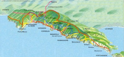
For hiking, C.A.I. route #2, from Monterosso to Riomaggiore, is an excellent route. It’s about 13km (8 miles) and takes you through Sentiero Azzurro, along the coast overlooking the sea.
Monterosso – Vernazza: 90 minutes
Rough narrow trail, steep at times. Beautiful views of Vernazza.
Vernazza – Corniglia: 90 minutes
The greenest hike of the coast, steep at times.
Corniglia – Manarola: 45 minutes
A broad and scenic low trail past a beach.
Manarola – Riomaggiore: 20 minutes, flat
The famous Via del amore, paved trail cut into the cliff. Stairs lead down to sunbathing rocks.
Riomaggiore down the headland to Portovenere: approx. 6 hours
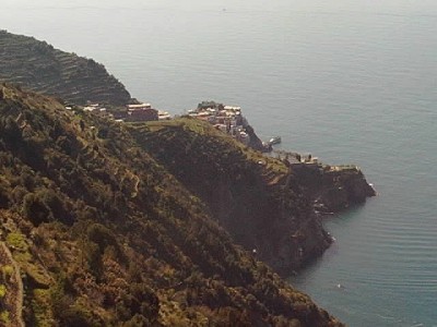
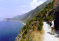
Left: This picture was taken on the high trail, a little harder find, but superb views and far fewer people.
Right: Lower trail – by Tessin Papa
Hiking Resources
Have a look at some steeper, more adventurous routes at Footpaths of the Cinque Terre, by the Tourist Association Cinque Terre.
Pictures of the hiking trailsfrom monterosse.com.
Reader Comments
– Ariane De Rooy
– Doug Burger, June 2002
– Andrew Geering
– Anonymous, March 2001
I’d put off the hardest segment of the “blue trail” (Vernazza to Monterosso) until after you’d already seen: the “Torre Guardiola” trail from Riomaggiore’s beach (the best vegetation, and clear views up and down the coast), the hike from Volastra to Corniglia (fabulous, level trail about 300 meters above the sea, much nicer than Manarola to Corniglia), the sanctuary above Riomaggiore, and the monastery on the hill that divides Monterosso.
Riomaggiore, Manarola, and Vernazza are each fascinating to explore, with a lot of hill-climbing involved. For the higher elevation walks, you can get a head start by catching buses from La Spezia to Volastra, Biassa, Campiglia or Portovenere (all worth it just for the ride alone). The all-purpose bus-stops (with schedules and ticket machines) are on Via Chiodo, at the foot of the main street Corso Cavour.
The tourist office at La Spezia station has a good booklet on the region and an adequate hiking map for free (maybe also at Riomaggiore station). Find the “client service” office at La Spezia station for a timetable of Cinque Terre trains; the information window doesn’t have them (if you’re traveling in Italy for more than a few days, spend L4000 for the master schedule book “In Treno” at a station newsstand).”
– Paul Sullivan
Swimming
There are two decent beaches in Cinque Terre. Both are fairly small and both cost 5’000 lire to use.
Monterosso Beach
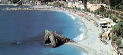
The first one is opposite the train station in Monterosso. It has deck chairs, changing rooms, snack bars and a life guard. Do not swim if the red flag is flying!
Guvano Beach
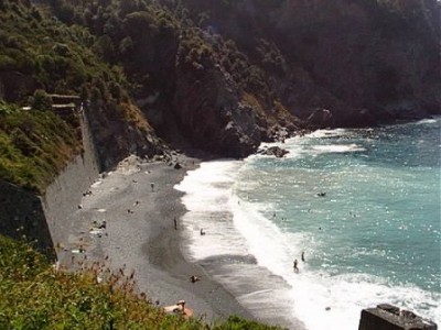
The second beach is in a beautiful, secluded valley between Corniglia and Vernazza. Not many tourists know how to get to it. Guvano beach has none of the facilities of the Monterosso beach and is so secluded that some people bathe nude, but you do not have to. Guvano is an official nudist beach.
To get there:
- Walk from Corniglia train station to the stairway up to the village.
- Continue past the stairway and down the ramps to the wall above the sea shore.
- Walk to the right, follow the path in among some houses to the entrance of a disused railway tunnel.
- Ring the bell to the left of the gate in the entrance to the tunnel. The gate will open automatically.
- Walk through the lighted tunnel, it takes about 10 minutes. At one point you can hear the trains passing behind a wall. The gate will close automatically behind you.
- Pay as you exit the tunnel and follow the foot path to the left down to the beach.
Other Beaches
There are two other beaches, one opposite Corniglia train station. This beach consists of big rocks and is so narrow that it disappears at high tide. The other beach is in the other Monterosso bay, it has boats and seaweed on it.
Reader Comments
– Nigel & Kate Roberts (July 2002)
– Massimo Guiggiani
– John (June 2001)
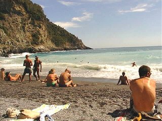
If you want to swim in the clearest water you have ever seen outside of the Greek islands, then walk around the left hand side of the harbor on the path which will lead you to a pebble ( actually more like smooth boulders ) beach. If you don’t mind a non-sand beach its a great place to swim and soak up the sun and admire the clearest water in the CT.
– Nigel & Kate Roberts (July 2002)

